Turkey Physical Map

Turkey Physical Maps depict a geography starting from sea level and rising to 5000 meters.
You can reach the peak of Kaçkar, which is approximately 4000 meters, by traveling 65 km from the Ardesen coast, from the zero point.
Or you can descend from the 3069-meter-high peak of Kizlar Sivri in Sarikaya National Park to the Finike coast in just 30 km.
For this reason, Türkiye Physical Maps have a natural beauty. For those who love...
Coloring of Regions According to Peaks

In a normal elevation map, we take Mount Ararat as a reference and make the sea level green.
In this analysis, I tried to obtain the peaks and valleys of each region numerically. The reason for the large single-colored areas in the Central Anatolia Region is the volcanic mountains. Karacadag affects the Southeast in a similar way.
I did not give a color to each elevation level, but a color according to how much it is separated from the region
In a classic elevation map, the peaks of Thrace are not visible because when compared to Eastern Anatolia, it looks like a plain.
Regional Peak Close-Up

500 meters Height
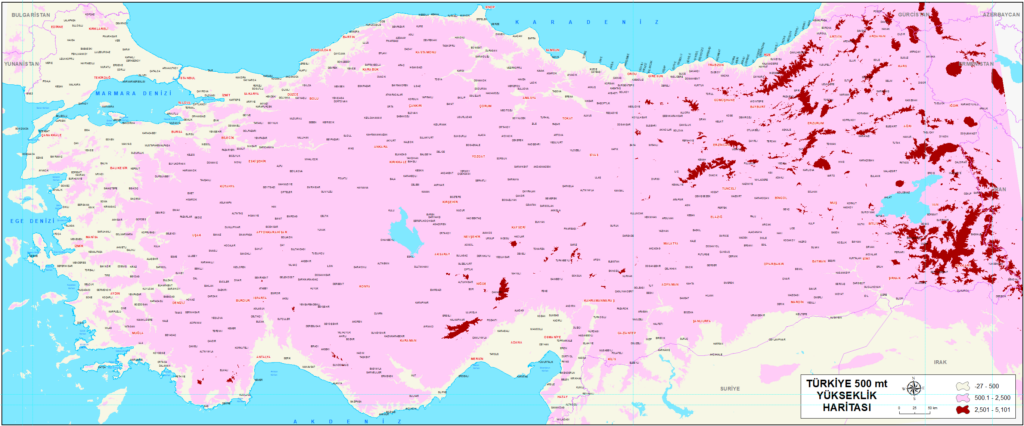
The 500-meter map shows us that Anatolia is a land mass rising rapidly from the sea. The majority of the population and developed metropolises are in this region.
Very few areas in the Marmara region are over 500 meters. There is no place under 500 meters in Eastern Anatolia and Central Anatolia.
We cannot say this for every place, but 500 meters also means irrigated agriculture.
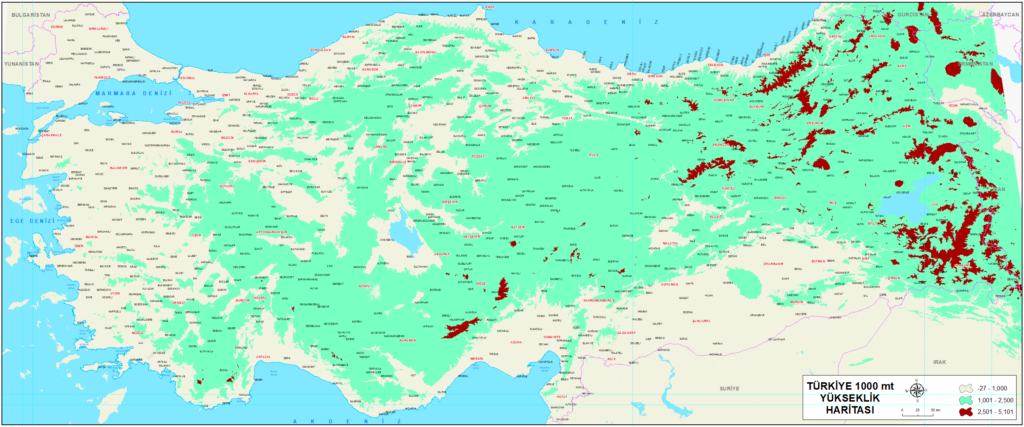
The 1000-meter elevation is like a picture of why Anatolia is called a plateau. It is also like a picture of the regions that receive snow every year.
When we look at 1000 meters, we see deep valleys: Sakarya, Kizilirmak, Yesilirmak, Çoruh, Dicle and Firat valleys that are now dams.
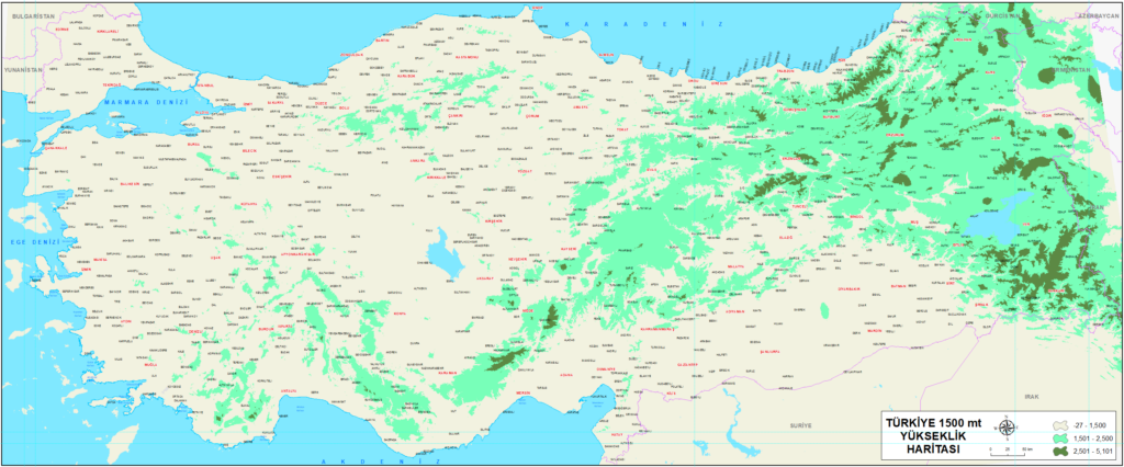
1500 meters depicts mountains. Areas where trees rarely grow, where agriculture is not done, where fruit is not grown. Population density almost drops to zero.
1000 meters Height
1500 meters Height
Mediterranean Physical Map

Aegean Physical Map

Eurasia Physical Map

Mugla Physical Map

Soft Colors Physical Map

Kahramanmaras Physical Map
