ESENTEPE
| Adi | ESENTEPE Province Affiliated | GÜMÜSHANE District Affiliated | MERKEZ Postal code | 29020 Number of Streets | 13 Population Density km2-people | 96.87 Number of Apartments with business Licenses | 5 Number of Apartments with Residential Licenses | 202 Number of Households / Families | 133 Total Population | 460 Male Population | 217 Woman Population | 243 Income Per Person - Spendable TL-Month | 15,868 |
|---|
ARZULARKABAKÖY BELDESI ESENTEPE Neighbourhood Map | Satellite View and Local Boundaries
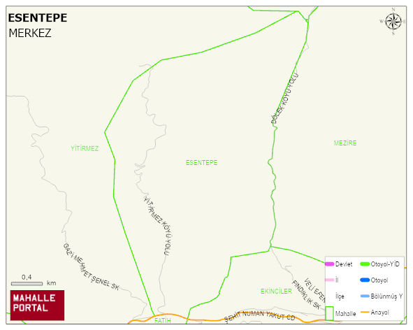
ESENTEPE Neighbourhood Digital Map | All Neighbourhoods and Settlements
ESENTEPE Neighbourhood – Population, Postal Code, Number of Workplaces
ESENTEPE - ARZULARKABAKÖY neighborhood is located in ARZULARKABAKÖY beldesi MERKEZ district of GÜMÜSHANE province. UAVT (National Address Database Code) Neighborhood Code: 140436. Postal Code: 29020. The population density is -per square kilometer- 75 people. ESENTEPE - ARZULARKABAKÖY 13 streets and avenues, 5 independent business licensed apartments, 197 residential licensed apartments, 107 households. 357 people live in this settlement. 176 male, 181 female. 60 and over is 113. The population rate of 60+ people is % 31
ESENTEPE Mahallesi
ESENTEPE Mahallesi için merak uyandıran başlıklar:
- 👥 Kimler yaşıyor? Nüfus, yaş, eğitim
- 🌍 Zemin sağlam mı? Fay hattı, deprem, rakım
- 🌱 Doğa & şehir dengesi Yeşil alan, tarım, konut
- ☀️ Hava nasıl? Sıcaklık, yağış
Kısa başlıklar ama bolca fikir: ESENTEPE Mahallesi’i keşfetmek için ideal!
ESENTEPE Neighbourhood Green Area, Housing, Commercial and Production Area Statistics
ESENTEPE Neighbourhood Physical Condition and Risks
| Earthquake acceleration rate -PGA 475 | 0.18 |
|---|---|
| Ground Disturbance Degree -4 | 1 |
| Broken Ground Ratio | 8 |
| Gas Stations | 0 |
| GÜMÜSHANE-BAYBURT AIRPORT DISTANCE -m | 20,305 |
| Distance to Fault Line (m) | 36,398 |
| Lowest Altitude (m) | 1,487 |
| Highest Altitude (m) | 1,487 |
| Avg Altitude (m) | 1,487 |
ESENTEPE Neighbourhood Meteorological Statistics > Climate
| Avg Temperature (°C) | 5.05 |
|---|---|
| Min Temperature (°C) | -23.01 |
| Rainfall amount (cm/day) | 2.97 |
| Snowfall amount (cm/day) | 0.83 |
ESENTEPE Neighbourhood | Residents come from which city? | Registry statistics of the inhabitants
| PROVINCE | POPULATION |
|---|---|
| GÜMÜSHANE | 341 |
| TRABZON | 17 |
| ADANA | 6 |
| GIRESUN | 6 |
| ORDU | 6 |
| ADIYAMAN | 4 |
| DIYARBAKIR | 2 |
| ERZURUM | 2 |
| HATAY | 2 |
| KAHRAMANMARAS | 2 |
ESENTEPE Neighbourhood Number of Singles | Number of Widows
ESENTEPE Neighbourhood Number of University Graduates | Education Statistics
Leave a Comment