DOLUKÜP Village – Population, Postal Code, Number of Workplaces
DOLUKÜP village MERKEZ district of TUNCELI province. UAVT (National Address Database Code) Village Code: 31333. Postal Code: 62002. DOLUKÜP 4 streets and avenues, 27 residential licensed apartments, 16 households. 46 people live in this settlement. 30 male, 16 female.
DOLUKÜP Village Digital Map | Boundaries of Villages
DOLUKÜP
| Adi | DOLUKÜP Province Affiliated | TUNCELI District Affiliated | MERKEZ Postal code | 62002 Number of Streets | 4 Population Density km2-people | 4.32 Number of Apartments with business Licenses | 0 Number of Apartments with Residential Licenses | 27 Number of Households / Families | 15 Total Population | 42 Male Population | 28 Woman Population | 14 Income Per Person - Spendable TL-Month | 4,271 |
|---|
DOLUKÜP Village Map | Updated Neighbourhood Map
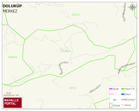
DOLUKÜP Village Digital Map | Boundaries of Villages
DOLUKÜP Köyü
DOLUKÜP Köyü için merak uyandıran başlıklar:
- 👥 Kimler yaşıyor? Nüfus, yaş, eğitim
- 🌍 Zemin sağlam mı? Fay hattı, deprem, rakım
- 🌱 Doğa & şehir dengesi Yeşil alan, tarım, konut
- ☀️ Hava nasıl? Sıcaklık, yağış
Kısa başlıklar ama bolca fikir: DOLUKÜP Köyü’i keşfetmek için ideal!
DOLUKÜP Village Green Area, Housing, Commercial and Production Area Statistics
DOLUKÜP Village Physical Condition and Risks
| Earthquake acceleration rate -PGA 475 | 0.31 |
|---|---|
| Ground Disturbance Degree -4 | 1 |
| Broken Ground Ratio | 46 |
| Gas Stations | 0 |
| ELAZIG AIRPORT DISTANCE -m | 36,647 |
| Distance to Fault Line (m) | 60,528 |
| Lowest Altitude (m) | 990 |
| Highest Altitude (m) | 1,396 |
| Avg Altitude (m) | 1,161 |
DOLUKÜP Village Meteorological Statistics > Climate
| Avg Temperature (°C) | 12.32 |
|---|---|
| Min Temperature (°C) | -14.40 |
| Rainfall amount (cm/day) | 3.56 |
| Snowfall amount (cm/day) | 0.65 |
DOLUKÜP Village Number of University Graduates | Education Statistics
DOLUKÜP Köyü 2024 Mahalli Seçim Sonuçları ve Katılım
DOLUKÜP Köyü ilçesinde 2024 yerel seçimlerinde (belediye başkanlık seçimi, mahalli idareler seçimi) aday oy oranları, katılım bilgileri, seçmen tercihleri ve belediye başkanlık sonuçları ayrıntılı şekilde sunulmaktadır.
DOLUKÜP Village Provincial Council Election| 2024
DOLUKÜP Village Number of Voters in the MProvincial Council Election | 2024
| Party | Votes |
|---|---|
| Neighborhood - Village | DOLUKÜP KÖYÜ |
| Number of Voters | 43 |
| Total Independent Votes | 8 |
| Number of Valid Votes | 26 |
2023 Parlamento Seçim İstatistikleri ve Sonuçlar - DOLUKÜP Köyü
2023 Parlamento (TBMM) Seçimleri kapsamında DOLUKÜP Köyü için oy dağılımları, parti performansları, meclis sandalye dağılımı ve Türkiye Büyük Millet Meclisi profili yer almaktadır.
2023 Cumhurbaşkanlığı Sonuç Profili - DOLUKÜP Köyü
2023 Cumhurbaşkanlığı Seçimleri DOLUKÜP Köyü için yapılan 1. ve 2. tur oylamalarda adayların oy oranları, katılım verileri ve Beştepe’ye gidecek isim analiz edilmektedir. Bu seçim devletin en üst makamı için yapılmıştır.